


McKinley County Precinct 1, McKinley County, New Mexico
About
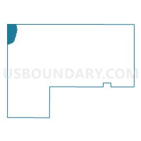
Outline

Summary
| Unique Area Identifier | 623709 |
| Name | McKinley County Precinct 1 |
| County | McKinley County |
| State | New Mexico |
| Area (square miles) | 90.33 |
| Land Area (square miles) | 89.43 |
| Water Area (square miles) | 0.90 |
| % of Land Area | 99.00 |
| % of Water Area | 1.00 |
| Latitude of the Internal Point | 35.90787450 |
| Longtitude of the Internal Point | -109.00462940 |
Maps


Graphs
Select a template below for downloading or customizing gragh for McKinley County Precinct 1, McKinley County, New Mexico


Neighbors
Neighoring Voting District (by Name) Neighboring Voting District on the Map
- Fort Defiance Voting District, Apache County, AZ
- McKinley County Precinct 3, McKinley County, NM
- McKinley County Precinct 4, McKinley County, NM
- San Juan County Precinct 9, San Juan County, NM
- Sawmill Voting District, Apache County, AZ
Top 10 Neighboring County Subdivision (by Population) Neighboring County Subdivision on the Map
- Fort Defiance CCD, Apache County, AZ (23,325)
- Navajo Nation CCD, McKinley County, NM (10,107)
- Naschitti CCD, San Juan County, NM (1,944)
Top 10 Neighboring Place (by Population) Neighboring Place on the Map
Top 10 Neighboring Unified School District (by Population) Neighboring Unified School District on the Map
- Gallup-Mckinley County Schools, NM (63,611)
- Central Consolidated Schools, NM (33,082)
- Chinle Unified District, AZ (20,202)
- Window Rock Unified District, AZ (11,846)
Top 10 Neighboring State Legislative District Lower Chamber (by Population) Neighboring State Legislative District Lower Chamber on the Map
Top 10 Neighboring State Legislative District Upper Chamber (by Population) Neighboring State Legislative District Upper Chamber on the Map
- State Senate District 2, AZ (177,904)
- State Senate District 4, NM (43,917)
- State Senate District 3, NM (41,208)
Top 10 Neighboring 111th Congressional District (by Population) Neighboring 111th Congressional District on the Map
Top 10 Neighboring Census Tract (by Population) Neighboring Census Tract on the Map
- Census Tract 9438, McKinley County, NM (6,253)
- Census Tract 9440, Apache County, AZ (6,043)
- Census Tract 9431, San Juan County, NM (1,943)